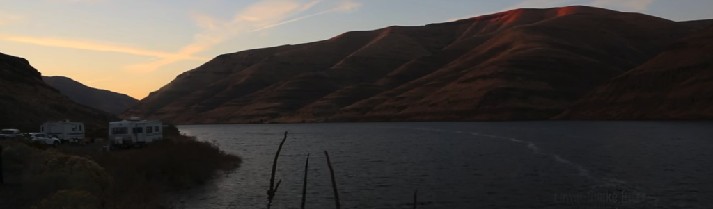
Rivers are the lifeblood of the West. They irrigate crops, provide clean drinking water, serve as habitat for fish and wildlife, and fuel an $887 billion outdoor recreation economy. Rivers are woven into the West’s outdoor heritage and our very identity as Americans.But rivers—from headwaters to ocean—are under immense pressure. Climate change, development, and an ever-changing landscape are placing growing stress on the waterways that are so inextricably tied to the health of Western communities and economies. As documented in The Disappearing West, growing human populations demand more from rivers: more water for cities; more diversions for irrigation and power generation; and more dams to manipulate natural river systems into performing for human needs. This development—which includes mining and urban sprawl—puts more strain on healthy, functioning river systems.
Through the Disappearing Rivers project, the Center for American Progress is providing the first comprehensive snapshot of the condition of Western rivers. To follow up on its groundbreaking Disappearing West analysis, CAP’s Public Lands Project partnered with Conservation Science Partnersto develop a tool to measure how rivers across the West have been affected by human uses of land and water resources. This project documentsthe extent to which rivers in the West have been dammed, diverted, or otherwise altered from their natural state by human development.
The results defy the conventional wisdom that western rivers flow wild and free. Nearly half of all river miles in the West—49 percent—are modified from their natural state. Once known for their dynamic character, 21 percent of rivers in the West no longer flow freely and a total of 140,000 river miles, or a distance long enough to circle the Earth nearly six times, have been altered by human uses. The development of lands adjacent to rivers is a primary cause of river degradation with 42 percent of rivers flowing through flood plains altered by human activity.
Often portrayed as continuous lines on a map, modern-day rivers are fragmented and impaired versions of their former selves. Waterways that once supported navigation and enabled adventurers to explore the West are no longer passable in their entirety. In fact, the average length of a river in the West has been reduced by 84 percent.
Fragmentation of Western rivers
The length of a river today is reduced by 84 percent from its natural state
Source: Dylan Harrison-Atlas and others, “Description of the approach, data, and analytical methods used to evaluate river systems in the western U.S.” (Truckee, CA: Conservation Science Partners, 2017), available athttps://disappearingwest.org/rivers/methodology.pdf.
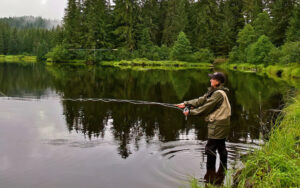
This fragmentation of rivers carries dire ecological and economic consequences. Fish and wildlife populations are being pushed to extinction, endangering local communities and jobs in the process. For example, new research finds that nearly 75 percent of California’s remaining species of salmon, trout, and steelhead will be extinct within 100 years. This loss will have devastating consequences for tribal nations, the fishing industry, and regional economies—Pacific salmon alone drives a $3 billion industry and supports tens of thousands of jobs.
With half of our rivers altered by development, the state of water in the West is bordering on a crisis.
Source: Dylan Harrison-Atlas and others, “Description of the approach, data, and analytical methods used to evaluate river systems in the western U.S.” (Truckee, CA: Conservation Science Partners, 2017), available athttps://disappearingwest.org/rivers/methodology.pdf.
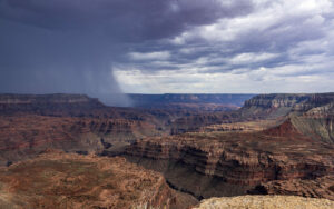
Major rivers—those large enough to support whitewater boating activities, or flowing at a speed of more than 163 cubic feet per second—are in the worst condition. A full 82 percent have been disrupted and altered by human development. From the iconic Colorado River to the roaring Rio Grande, most of our majestic waterways are no longer continuous or natural. These are the rivers that we raft and boat and that supply drinking water and critical irrigation for millions of Americans in the West. Some states have essentially no semblance of natural major rivers left. In Utah, for example, more than 99 percent of major rivers, including the Colorado River and the Green River, are altered from their natural state.Smaller rivers and streams—flowing from 6 to 163 cubic feet per second—are also altered beyond their natural state. Nearly half, or 48 percent, are clogged with dams, diverted for other uses, or affected by human development in the surrounding flood plains. Still, these rivers are economic drivers, fueling a $35 billionfishing industry, and their loss could be devastating for local communities. For example, many of the tributaries of the mighty Blackfoot River—a sought-after fly-fishing destination made famous in A River Runs Through It—are up to 50 percent altered.Perhaps most surprising is that headwaters—the high-elevation tributaries that feed rivers and streams and that evoke images of untouched and pure sources of our drinking water—are heavily modified. More than 35 percent of glacial-fed mountain streams and spring-fed babbling brooks are altered by human development. The South Fork of the Pit River—part of the headwaters of the Sacramento River that provide most of the water for the Central Valley of California—is already 84 percent altered at its source.
In aggregate, the changes made to Western rivers are astonishing. A fish can only swim less than one-half of 1 percent of a river before reaching a dam, diversion, culvert, or water that is somehow affected by human development.
River sizes
Source: Dylan Harrison-Atlas and others, “Description of the approach, data, and analytical methods used to evaluate river systems in the western U.S.” (Truckee, CA: Conservation Science Partners, 2017), available athttps://disappearingwest.org/rivers/methodology.pdf.